StructureScan Pro is a multipurpose concrete inspection system that provides a wide range of antenna options for concrete and other applications. Using the SIR 4000 controller, the StructureScan Pro offers GPR professionals solutions to any scanning situation.
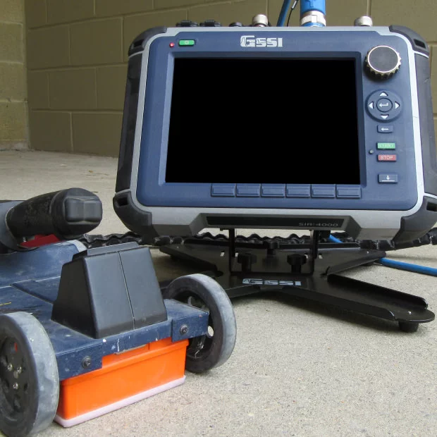
Image Credit: Geophysical Survey Systems
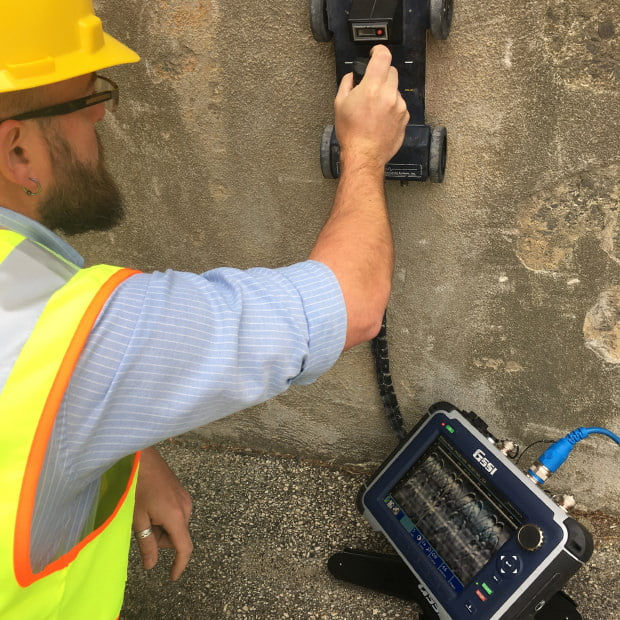
Image Credit: Geophysical Survey Systems
Applications
- Scan for rebar, post tension, conduits and non-metallic objects
- Concrete slab scanning
- Locate voids
- Concrete imaging
- Condition assessment
- Structural inspection
Features
- Sturdy transit case
- SIR 4000 control unit
- Lithium-ion battery (2)
- 1600 or 2600 MHz antenna
- Dual-bay battery charger
- Model 615 handcart with encoder
- Two-year warranty
- 7-m Control cable
Accurate, Reliable and Safe Concrete Imaging
The StructureScan Pro system offers a non-destructive means to precisely investigate concrete structures, locate voids and measure slab thickness.
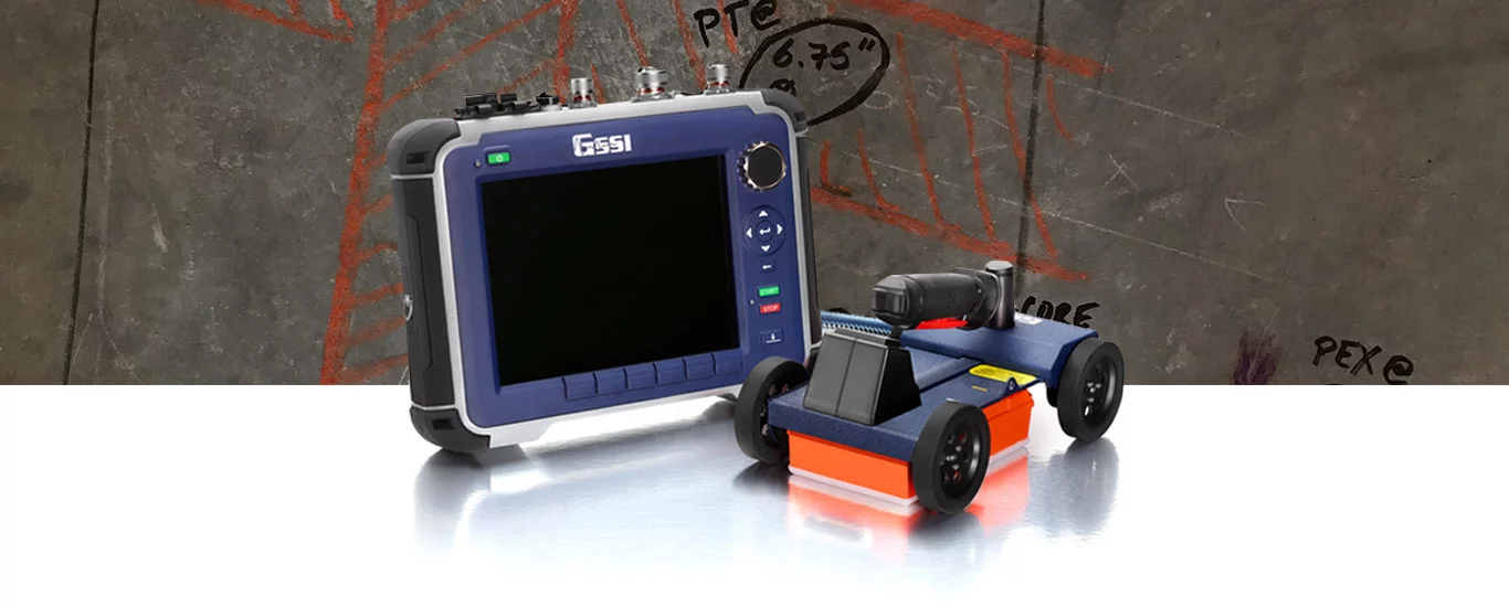
Image Credit: Geophysical Survey Systems
Locate Targets in Concrete
The StructureScan Pro locates PVC and metal conduits, rebar, voids and post tension cables.
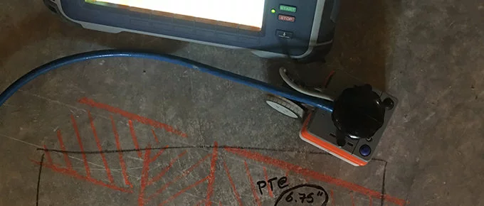
Image Credit: Geophysical Survey Systems
Premium Mobility
The sturdy handcart-based system is simple to transport and lighter. GPR is a secure technology without any site hazards or the necessity to cordon off work areas as is the case with radiography (X-ray).
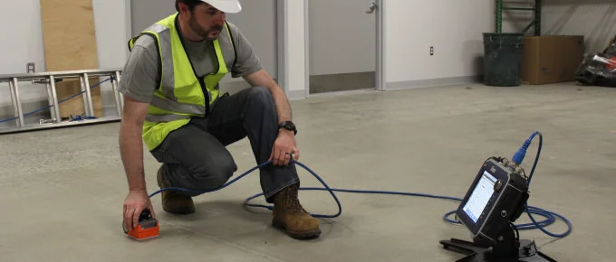
Image Credit: Geophysical Survey Systems
Fully Customizable System
The StructureScan Pro is available with two antenna options - 1600 or 2600 MHz. Engineered to fit users’ demands, the StructureScan Pro is compatible to expand survey capabilities, like bridge and utility applications, with antenna upgrades.
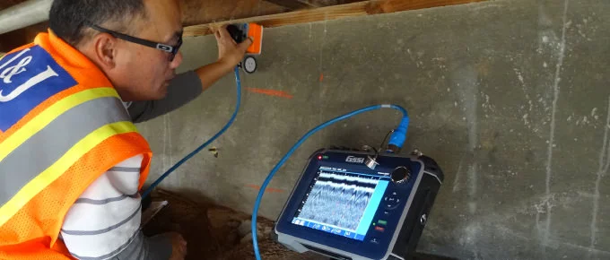
Image Credit: Geophysical Survey Systems
Data Examples
Real-Time Locating
Data shows a concrete slab strengthened with wire mesh at different depths and a conduit.
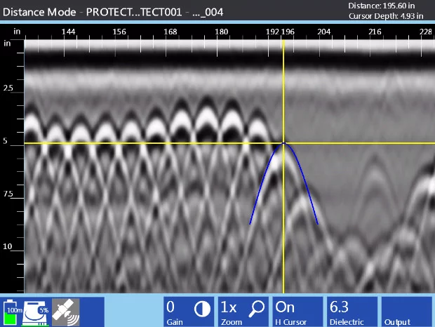
Image Credit: Geophysical Survey Systems
3D Concrete Imaging
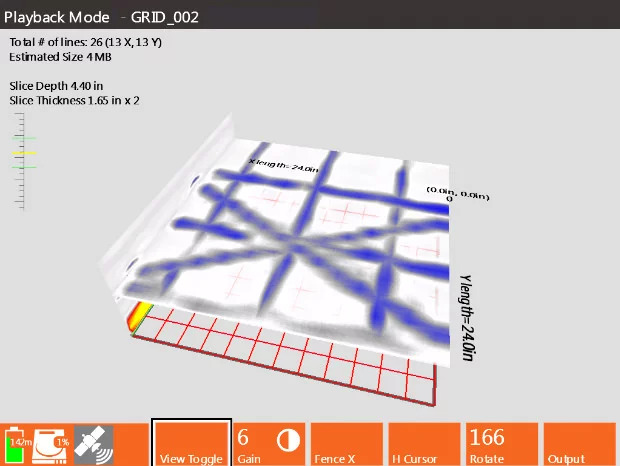
Image Credit: Geophysical Survey Systems
Data illustrates a concrete slab reinforced with post-tension (PT) cables and rebar.
Specifications
Source: Geophysical Survey Systems
| System |
SIR 4000 |
| Antennas |
Compatible with all GSSI antennas |
| Number of channels |
Records data from 1 single-frequency antenna or 1 dual-frequency antenna |
| Data storage |
32 GB Flash, 1 GB RAM |
| Display |
10.4” LED |
| GPS |
Data logged internally |
| Display modes |
Linescan, Full 3D |
| Environmental rating |
IP64 |
| Data acquisition |
|
| Data format |
RADAN® (dzt) |
| Output data format |
32-bit |
| Scan interval |
User-selectable, up to 4000 scans/sec |
| Number of samples per scan |
256, 512, 1024, 2048, 4096, 8192, 16384 |
| Operating modes |
Continuous (time) or survey wheel (distance triggered) or point mode |
| Time range |
0-20,000 nanoseconds full scale, user-selectable Gain: manual adjustment from -42 to +126 dB Number of segments in gain curve is user-selectable from 1 to 8 |
| Standard real-time filters |
Infinite Impulse Response (IIR) - Low and High Pass, vertical and horizontal - Finite Impulse Response (FIR) - Low and High Pass, vertical and horizontal |
| Advanced real-time filters |
Migration, Surface Position Tracking, Signal Noise Floor Tracking, Adaptive Background Removal |
| Automatic system setups |
Storage of an unlimited number of system setup files for different survey conditions and/or antenna deployment configurations |
| Automatic antenna recognition |
Automatic recognition of Smart Antennas to allow maximum compliant transmit rate |
| Languages |
| English, Chinese, Japanese and French |
| Operating |
| Operating temperature |
-20 °C to 40 °C (-4 °F to 104 °F) |
| Battery |
Inspired Energy Ni2040ED, 3 hour runtime (battery life dependent on level of display brightness) |
| Transmit rate |
Up to 800 KHz (International) US/Canada and CE rates depend on antenna model |
| Input/Output |
| Available ports |
Analog and Digital, RS232, HDMI, Ethernet to PC, USB 2.0 port and mini USB |
| Ethernet |
RJ45 100BT Ethernet |
| USB host |
USB host with external keyboard support, USB flash drive support and USB HUB support |
| Mechanical |
|
| Dimensions |
14x10x2.75 in (36x25x7 cm) |
| Weight |
10 lbs (4.53 kg) including battery |
| Relative humidity |
<95% non-condensing |
| Storage temperature |
-40 °C to 60 °C (-40 °F to 140 °F) |
Accessories
SIR 4000 Stand
The SIR 4000 stand has been engineered for concrete applications where it is necessary to prop up the control unit to visualize the data. This stand comes with user-replaceable plastic feet that have been engineered to enable the stand to be used on rough surfaces.
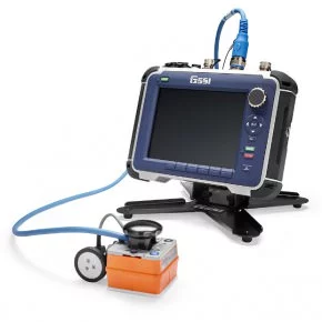
Image Credit: Geophysical Survey Systems
SIR 4000 Carry Harness
The SIR 4000 harness has been engineered for applications in which the user has to use both hands for the survey. The harness can be mounted onto the waist and shoulders of the user to easily distribute the controller’s weight.
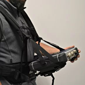
Image Credit: Geophysical Survey Systems