The UtilityScan from Geophysical Survey Systems Inc. (GSSI) has a lightweight, wireless configuration. Thanks to its patented HyperStacking technology, the system offers unmatched data quality and an integrated LineTrac system. This advanced system sets a new benchmark in price and performance.
Applications
- Identify soil and foundation characteristics
- Scan utilities - metallic and non-metallic
- Locate shallow objects in the field of archaeology
- Detect voids and underground storage tanks (USTs)
- Locate water lines
Features
- Lithium-ion battery (2)
- 350 HS antenna (350 MHz)
- Quick Start Guide
- Dual-bay battery charger
- Zebra L10 Rugged Table
- Sunshade for Zebra tablet
- Rugged 2-m ethernet cable
- LineTrac, optional
- Two-year warranty
UtilityScan GPR for Utility Locating
Video Credit: Geophysical Survey Systems
The New Tool for Underground Utility Locating
The UtilityScan from Geophysical Survey Systems is considered to be the ideal blend of price and performance. This system has been constructed with the latest HyperStacking Technology, for increased depth penetration and high-resolution data.

Image Credit: Geophysical Survey Systems
Compact and Portable
The UtilityScan system seems to be unbelievably compact. It weighs only 34 pounds and can be collapsed to fit at the back of a small vehicle or even in an airline overhead compartment. Also, the system features an adjustable handle featuring dual pivot points for user-friendliness.
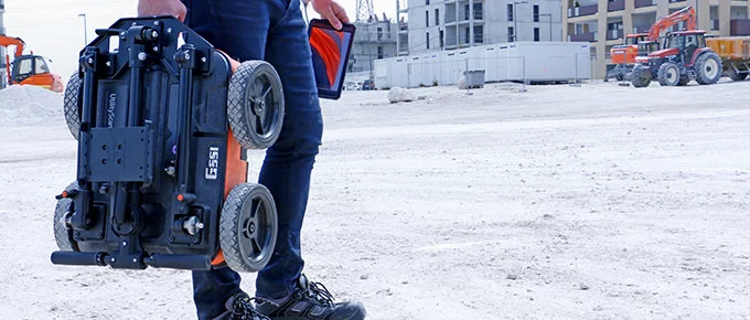
Image Credit: Geophysical Survey Systems
Premium Features, Entry-Level Price
The perfect underground locator reaches greater depth penetration and offers clearer information with patented HyperStacking Technology. The UtilityScan features real-time gain control and data presentation. All this can be packaged in a precise GPR unit.
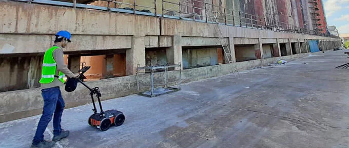
Image Credit: Geophysical Survey Systems
Advanced Capabilities
UtilityScan comes standard with an internal GPS or can be integrated with a user-provided GPS. This system has an option to add the LineTrac power detection module. LineTrac allows users to detect AC power and induced RF energy present in buried utilities.

Image Credit: Geophysical Survey Systems
Data Examples
Deep UtilityScan Data
UtilityScan Data exhibiting deep stratigraphic features in a resistive soil.
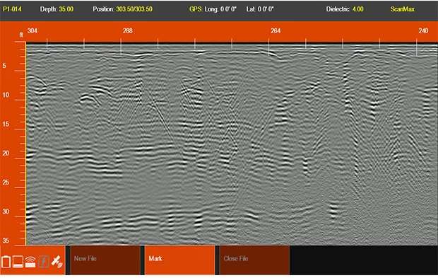
Image Credit: Geophysical Survey Systems
Dynamic Gain Control
Data exhibits varying subsurface conditions and several unknown targets. Green LineTrac peak denotes the existence of live power and helps the user verify valid target identification.
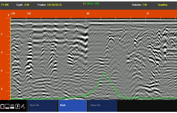
Image Credit: Geophysical Survey Systems
HyperStacking and LineTrac
Data demonstrates various metallic and non-metallic targets at several depths. Yellow cross hairs determine a water line at 3 ft (1 m) in depth, and blue LineTrac peak denotes the detection of an induced 33-kHz active frequency.
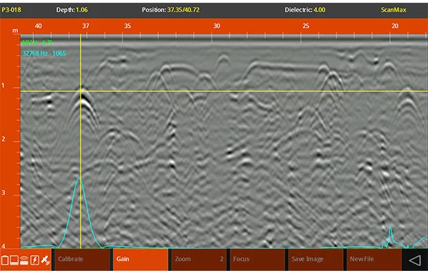
Image Credit: Geophysical Survey Systems
Specifications
Source: Geophysical Survey Systems
| . |
. |
| Display |
10.1” |
| Environmental rating |
IP65 (tablet dependent) |
| Display modes |
Linescan and Focus Mode |
| Available ports |
(2) USB 2.0, Type C USB, RJ-45 |
| Data collection speed |
<3.5 mph (6.5 km/h) |
| Operating temperature |
-20 °C to 40 °C (-4 °F to 104 °F) |
Accessories
Model 656 Rugged Cart
The Model 656 rugged four-wheel cart has been particularly developed for the UtilityScan system. This cart is meant for rough variable terrain.
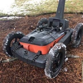
Image Credit: Geophysical Survey Systems
Model 626 3-Wheel Cart
The Model 626 cart is an extra cart option that has been developed for the UtilityScan System. This three-wheel cart consists of a particularly built center-positioned bracket to retain the UtilityScan system chassis. The 626 cart is better suited for unequal grassy fields and terrain areas.
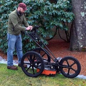
IImage Credit: Geophysical Survey Systems
Battery Booster Kit with Cable for Consumer-Grade Tablet
The battery booster kit that comes with cable is an extendable battery for the consumer-grade tablet. Normal battery life with a power booster is nearly 8+ hours.
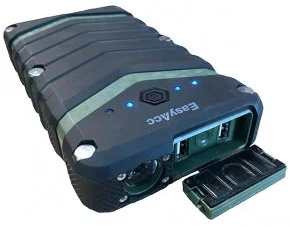
Image Credit: Geophysical Survey Systems
Transit Case for UtilityScan
This custom foam Pelican Case has been developed for the UtilityScan system and all its accessories. This transit case is designed for users who need to ship or safeguard the system from wet or unsafe surroundings.
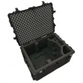
Image Credit: Geophysical Survey Systems