UtilityScan DF from Geophysical Survey Systems Inc. (GSSI) integrates the innovative dual-frequency digital antenna (300 and 800 MHz) and a user-friendly touchscreen interface to view deep and shallow targets concurrently in a single scan.

Image Credit: Geophysical Survey Systems
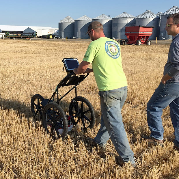
Image Credit: Geophysical Survey Systems
Applications
- Geological investigation
- Utility detection
- Archaeology
- Environmental assessment
- Forensics
- Damage prevention
- Road inspection
Features
- Panasonic G1 Toughbook
- Lithium-ion battery (2)
- 300/800 MHz DF antenna
- Transit case
- Choice of 2-wheel or 4-wheel cart
- Dual-bay battery charger
- 2-m digital control cable
- Two-year warranty
Dual-Frequency Digital GPR System
The UtilityScan DF consists of the latest features, like the patented Blend Mode technology and dual-frequency digital antenna.
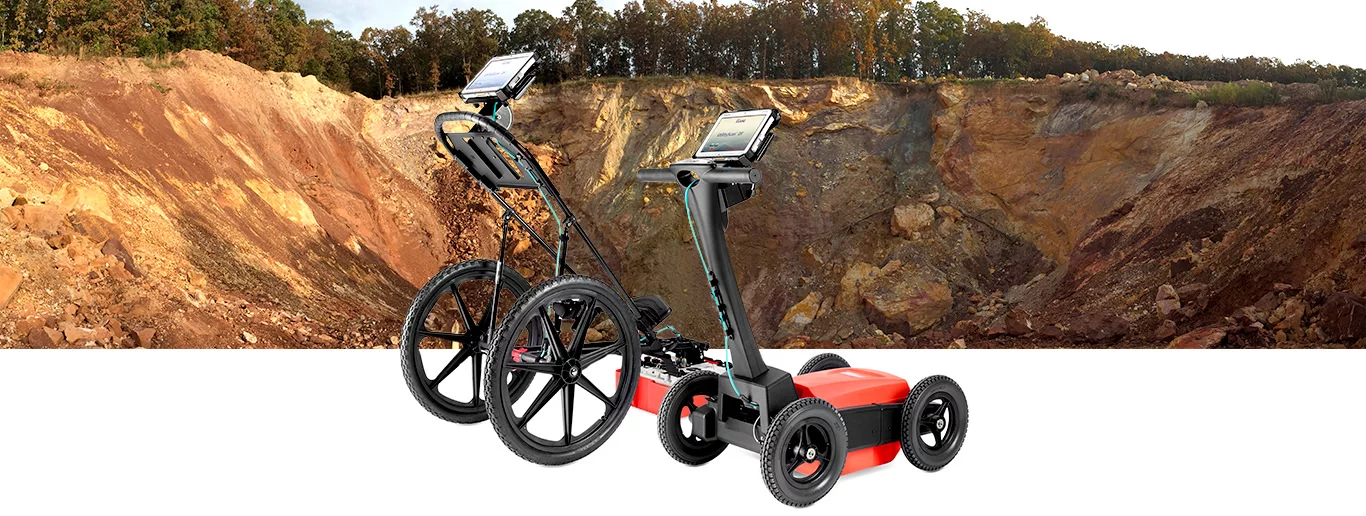
Image Credit: Geophysical Survey Systems
Target Designation
The UtilityScan DF features real-time data collection. This portable GPR unit consists of a backup cursor and cross-hair cursor that enable the user to confidently mark targets.

Image Credit: Geophysical Survey Systems
Premium Mobility
UtilityScan DF consists of two various cart options to improve user-friendliness on all job sites. The four-wheel rugged cart has been constructed to resist the toughest job sites, while the two-wheel cart is lightweight and simple to transport.

Image Credit: Geophysical Survey Systems
Enhanced Software Capabilities
Numerous modes are available to view gathered data. The patented blend mode integrates high-resolution near-surface data with lower depth details into one “blended” data set.
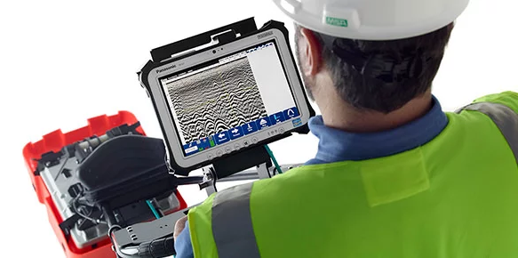
Image Credit: Geophysical Survey Systems
Data Examples
Blend Mode
Data demonstrates various metallic and non-metallic targets at several depths in blend mode. The green shaded area constitutes estimated signal floor. The red or blue dotted line determines the soil velocity calculation tool.
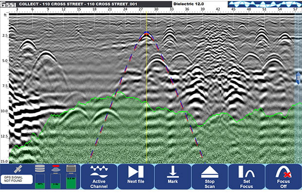
Image Credit: Geophysical Survey Systems
3D Mode
Data demonstrates three metallic targets at a depth of 1, 2 and 3 feet gathered at GSSI’s utility test pit utilizing 3D mode.
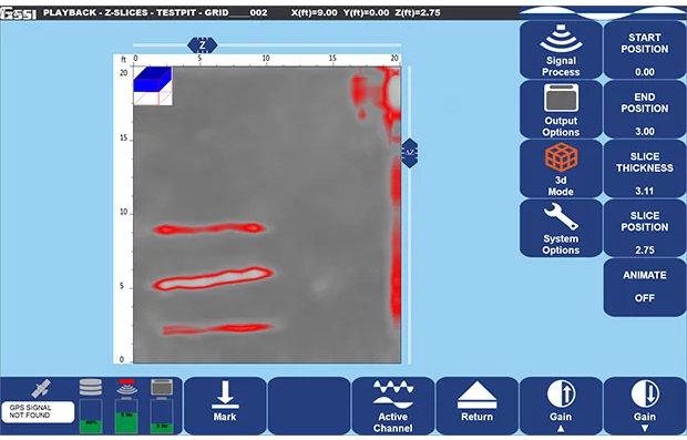
Image Credit: Geophysical Survey Systems
Specifications
Source: Geophysical Survey Systems
| . |
. |
| Display |
10.1" |
| Environmental rating |
IP65 |
| Display modes |
Linescan, Dual and Blend Mode |
| Available ports |
USB 3.0, Ethernet and Serial |
| Languages |
English and French |
| Operating temperature |
-10 °C to 50 °C (14 °F to 122 °F) |
Accessories
Sunshade for Panasonic G1
The sunshade for the Panasonic G1 enables users to view the screen freely in high ambient light conditions. The sunshade features a unique slot for finger access for the touchscreen display.
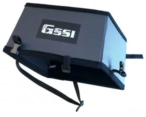
Image Credit: Geophysical Survey Systems
LineTrac
LineTrac adds the benefit of detecting AC power and induced RF energy present in buried utilities. This accessory is consistent with the 300 or 800 DF antenna and the 350 HS antenna.
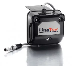
Image Credit: Geophysical Survey Systems